The remains of a newspace startup.
Featured

The Guts of a Startup
After 7 years of hard work, our passion project, our beloved venture, our partnership has come to an end. Like countless other startups, Tesselo has...

All Stories
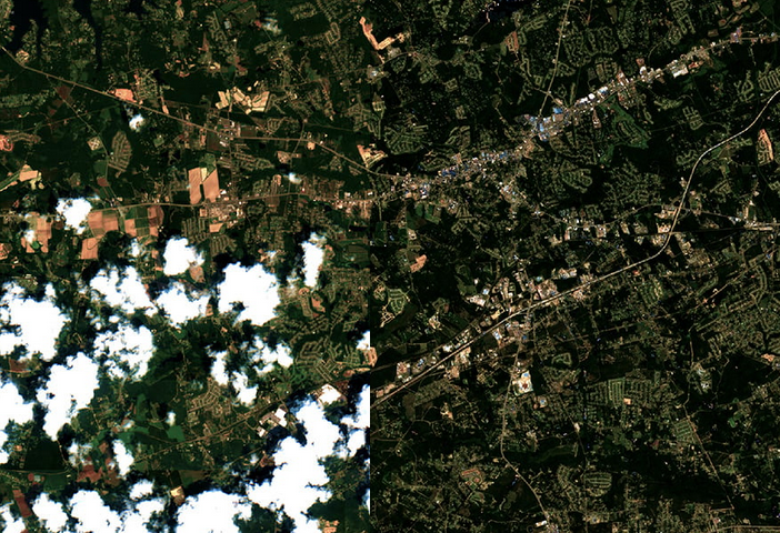
EO data pipeline
Transforming raw EO imagery to analysis ready data requires a lot of preparation. At Tesselo we focused a large part of our platform on the pre-processing of EO data.


Brand Book
Our Brand Book has been developed by ADDB. It is beautiful and served us well. We are happy to share it here.
Focus Thursdays
Focus day is an alternative to the more common No meetings day. We put emphasis in the meaning of focus, not the meeting schedule.

Communications Netiquette
A guide on how to be dignified, elegant, and gracious in our social interactions through the internet at Tesselo.